Navigation and radar · 10 min read · Updated 2026-08-12
Navionics vs C-MAP for Australian charts
The argument is not which logo is prettier. It is which card you will keep current for the bar, the reef and the next software generation of your MFD.
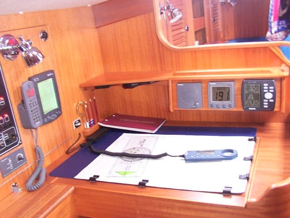
Photo: Chart table on a Hallberg-Rassy 36 with GPS, NMEA instruments and DSC VHF by Pete Verdon. Licensed under CC BY-SA 3.0. Source on Wikimedia Commons. Also listed on the AM Wholesale image credits page.
Australian skippers inherit a chart religion with the boat: Navionics on Garmin-heavy helms, C-MAP on a lot of Simrad and Furuno glass, and a long tail of older cards that have not seen an update since the last owner. The archived wholesale brand wall listed both Navionics and C-MAP by Jeppesen. That pairing was correct then and is still the useful comparison now.
This is not a laboratory bake-off. It is a buying and currency piece.
What both products actually are
Both are licensed cartographic layers drawn over hydrographic source data, plus the vendor’s extra: satellite overlays, community sonar, marina notes, and a subscription that expires. Neither is “the official chart” in the AMSA sense. If you need official ENC behaviour for a commercial job, that is a different conversation.
For a recreational or light-charter cruiser, the question is coverage of the water you use and whether your MFD family still treats that card as a first-class citizen.
Navionics, in Australian practice
Navionics is the default language of many Garmin owners and a large share of phone-plus-plotter skippers. The phone app is how a lot of Gold Coast trailer-boat owners already “have charts” before they own a plotter. Strengths: easy rehearsal at the kitchen table, sonar-chart storytelling, and a huge installed base.
The risk is treating the phone as the helm, and treating community sonar as a survey of last Tuesday’s sandbar. Moreton Bay and the Broadwater punish that habit.
C-MAP, in Australian practice
C-MAP still shows up wherever Simrad, some Furuno setups and commercial-leaning helms are specified. Full-featured layers and a more “charty” look appeal to skippers who came off paper. Strengths: a serious coastal folio feel, and a licensing model that some yards already know how to renew.
The risk is buying a pretty C-MAP card for a display family that would rather speak Navionics, or the reverse.
How to choose without a forum fight
- What does the MFD actually prefer? Start with the brand comparison.
- What water do you run? Reef, bar, or a single estuary. Download or view the exact folio before you pay.
- Will you renew? An expired subscription is how people hit new rock. Put the renewal on the same calendar as the EPIRB battery.
- Backup. A second plotter, a phone with an offline folio, or paper for the bars. See GPS plotter installation mistakes for the power and antenna half of that backup.
Charts do not replace radar, AIS or a lookout. They tell you what the last survey thought was there. Pair this piece with the navigation hub and keep a pencil.
Frequently asked questions
- Can I run both Navionics and C-MAP on one display?
- Some MFDs will host both; many will not. Confirm the card slots and the licence before you buy a second subscription “just in case”. One current chart is safer than two expired ones.
- Are community edits reliable in the Broadwater?
- They are a hint, not a survey. Sand moves. Treat sonar-logged community depths as gossip from last month’s tide.
- Do I still need paper?
- A small paper folio of the bars and harbours you actually use is cheap insurance against a dark, wet MFD. It is not nostalgia. It is a backup that does not need 12 volts.